Tannenberg
Before the German attack on Western Europe (Fall gelb) the germans built several intended FHQ and one of them was Tannenberg in the Black Forest nature reserve. Tannenberg was outside a small town called Kniebis, about ten kilometres west of Freudenstadt. The reason the Germans chose Kniebis was that there were already existing defence facilities (flaks etc) in the area. Construction of Tannenberg began in October 1939 and was completed in the summer of 1940. By then the Germans had already defeated France. During Fall Gelb (Germany attack on Western Europe), Hitler spent time in both FHQ Felsennest (Germany) and FHQ Wolfssshlucht 1 (Belgium). Wether Hitler intended to use Tannenberg we don’t know. But if France had continued to fight instead of capitulating in June 1940, by withdrawing their forces southwards, it is likely that Hitler had used Tannenberg as it would have been closer to the front.
Hitler arrived in Tannenberg from Wolfsschlucht 1 in Belgium on June 27, 1940. Tannenberg consisted of a few bunkers and a few wooden barracks and the information about Tannenberg’s lay out is inadequate. From Tannenberg Hitler made excursions to the battlefields in France and he also visited a military hospital in Freudenstadt and received members from the Nazi female youth movement, Bund deutscher mädel (BDM). The military conferences were held outdoors due to the heat and humidity in the bunkers. Hitler left Tannenberg for Berlin on July 5, 1940, with his special train America and arrived the following day. Remaining in Tannenberg was only a small guard force and Hitler never returned to Tannenberg. After the war, Tannenberg was destroyed.
Current status: Demolished (2009).
Location: 48°29'55.30"N 08°15'43.52"E
Get there: Car.
Follow up in books: Seidler, Franz W. & Zeigert, Dieter: Hitler’s secret headquarters (2004).
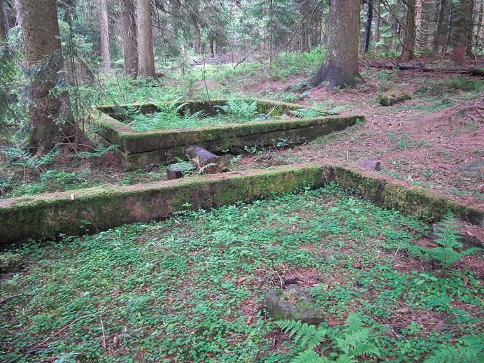
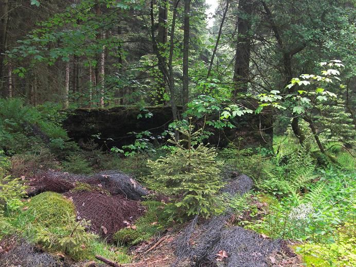
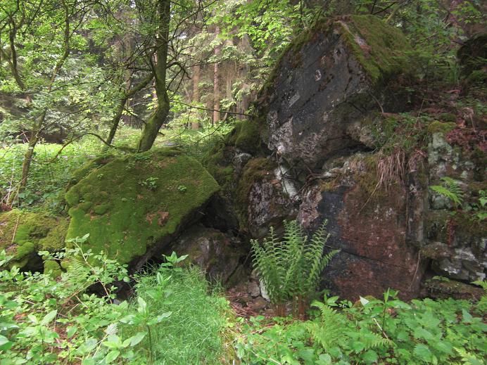
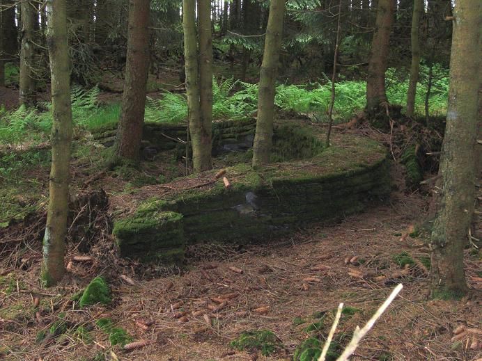
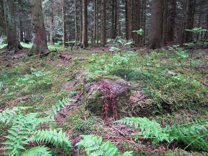
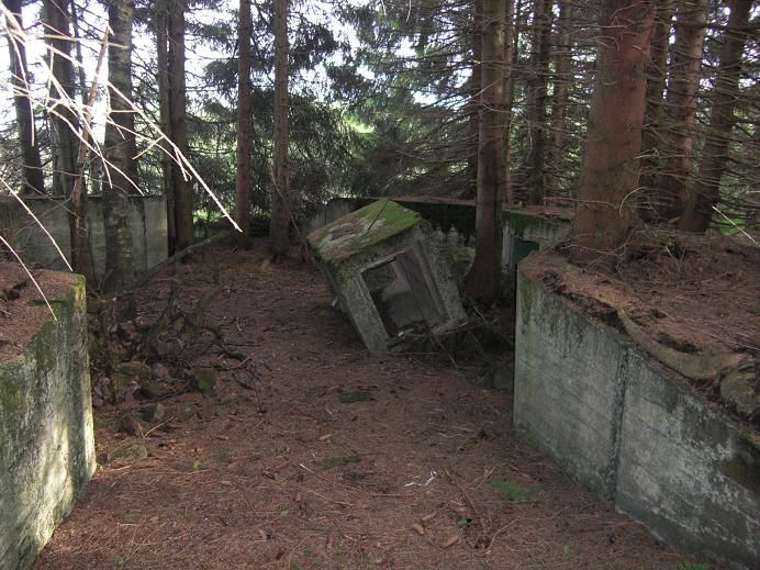
Without local knowledge, the ruins of Tannenberg are very difficult to find as they lay inside the forest and are about to become one with nature. It is mainly from two perspectives that there is a hope that the place will remain relatively unknown. The first is that the place is located near a nature reserve that cannot be entered. The second is that if the site becomes a tourist attraction, the state of Baden-Württemberg might decide to remove the ruins to put an end to ”Hitler tourism”. Given the lack of information about Tannenberg’s lay out, the removal of the ruins would make it impossible to chart the site. When I visited the site in 2009, I had to promise the guide not to reveal its exact location. Ten years later and with the help of Google Earth, it is no longer any difficulty to find its location. Therefore I don’t see any reason for not publish the coordinates.