Howth – Eire 6
During the Second World War Ireland declared itself neutral, but its geographical proximity to England (especially Northern Ireland) made it exposed. Starting in September 1940, and until mid-May 1941, the German air force (Luftwaffe) carried out continuous heavy air raids against British cities what has been known as the Blitz. Around the same time, though on a smaller scale, the British air force (RAF) also began to carry out sporadic air raids against German cities. If German air raids lost strength from May 1941, British air raids increased from 1942 and onwards.
The technic used for navigation left a lot to be desired when bombers, regardless of nationality, tried find their targets and return safely back home. In darkness or bad weather, it was even harder to navigate correctly. Even in clear weather, it could be difficult to know where you were if the crew for whatever reason lost orientation.
Irish authorities wanted to minimise the risk of being mistaken for English territory and having foreign aircraft landing on Irish soil. Therefore, along the Irish coast, 83 large markings were established with the text Eire followed by a number. This would inform lost pilots that it was Ireland below them and nothing else. About 15 kilometers east of Dublin, there is a small town called Howth, where along the coast a mark was located with the inscription Eire 6.
Current status: Restored with monument (2023).
Location: 3°22' 29.30" N 06°02' 58.24" W
Get there: Car.
Follow up in books: Holland, James: The Battle of Britain: Five Months That Changed History; May-October 1940 (2011).
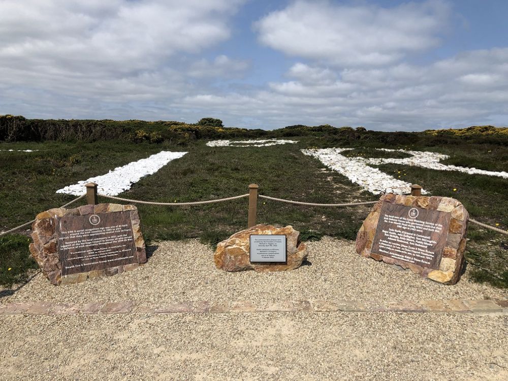
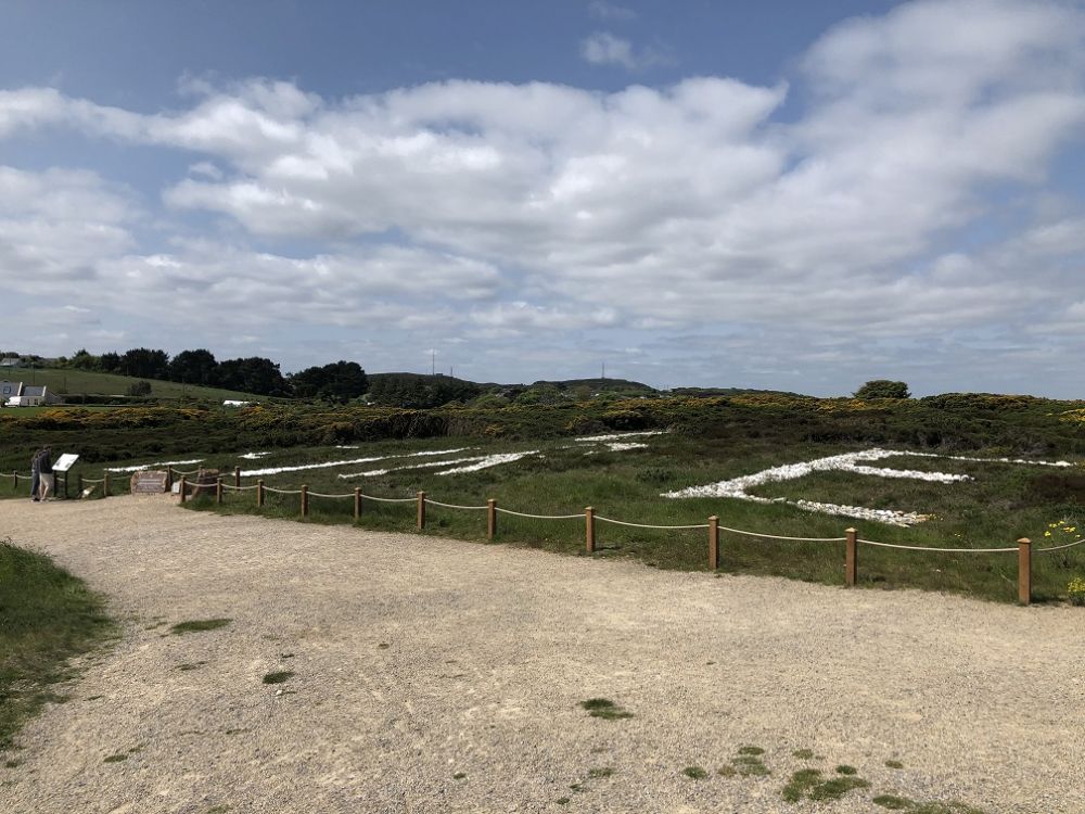
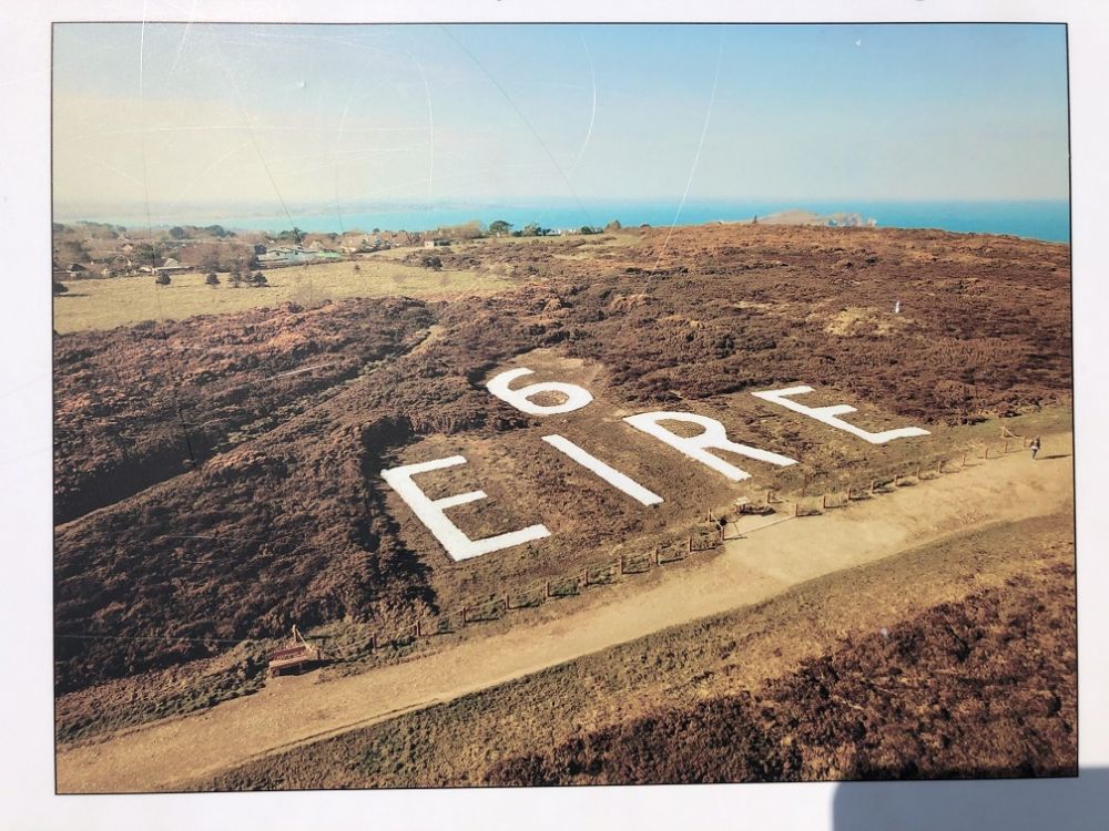
The mark is beautifully situated next to the coast and was restored by a non-profit association as late as 2022. Its location also makes it easily visible for incoming planes about to land at Dublin Airport, although today’s pilots have other means of finding their way.